- Volcanic Geothermal Systems need to have geophysical field surveys performed to be used in the evaluation of thermal resources, in the construction of structural models, and to facilitate decisions about proceeding with more expensive drilling of wells.
- Geophysical surveys would include field work to measure physical parameters associated with:
- Temperature (thermal gradients)
- Electrical conductivity (resistivity) (electrical (MT and AMT), electromagnetic (EM))(fluids)
- Seismic reflections (less applicable in poorly reflective areas)
- Density (gravity to identify shallow concealed structures and density anomalies)
- Magnetic susceptibility (magnetic survey to identify faults and lithologies)
- The data collected could provide information on the shape, size, depth of geological structures. Potential altered clay cap layers and underlying hydrothermal reservoirs could be identified. Upflow zones and conduits could be identified.
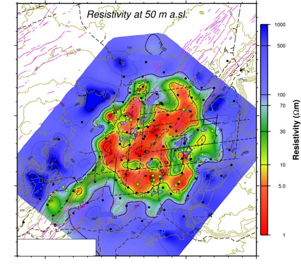
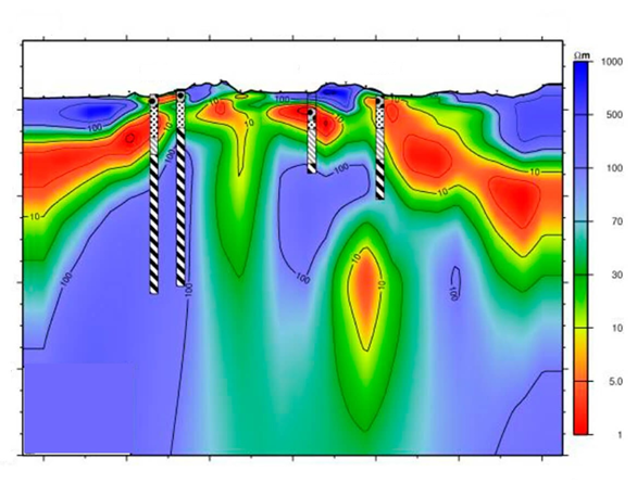
- For shallow hydrothermal reservoirs, 3D magnetotellurics is one of the most important exploration technologies and there are various types (i.e., 2D, 3D, surface, aerial, audio-MT, etc.) and the nature of the location (topography, access issues, etc.) would help the selection. Identifying the relative resistivities between altered clay cap layers and underlying reservoir is commonly used to help understand the reservoir size, thickness, etc. and give some initial ideas about where to located the initial well target locations. Sometimes upflow can be imaged depending on depth and size.
- •Combined with understanding regional and local geology (from geological field work), this data helps provide the input required to construct numerical simulation models.
