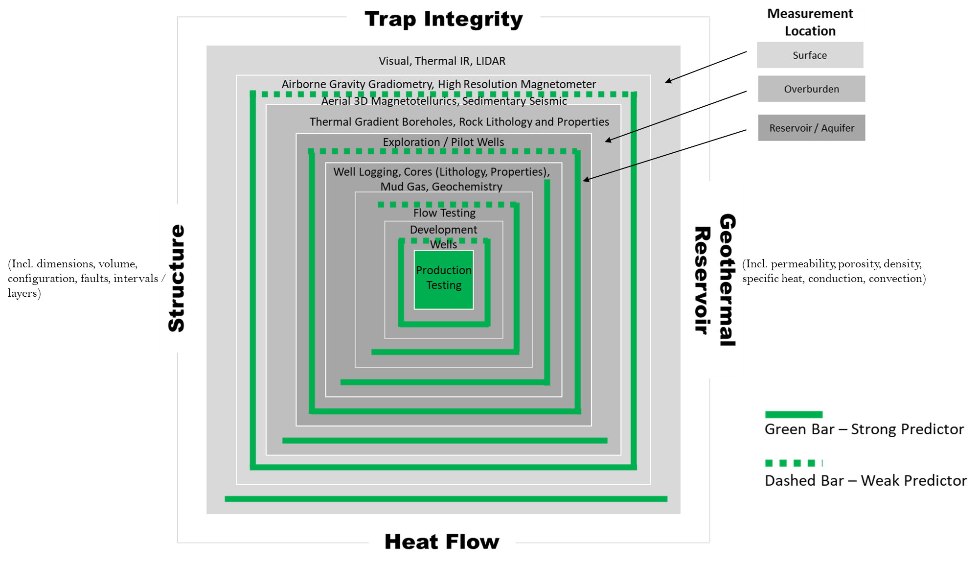
- Once a location has been identified by geological field work, geophysical exploration field work could involve several technologies to obtain more detailed subsurface data:
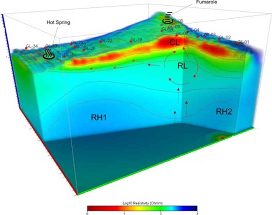
- Magnetotellurics(MT) surveys mapping the location and geometry of potential hydrothermal reservoirs via the electrical resistivity contrast with surrounding rock. Thermal fluids in the subsurface affect electrical resistivity leading to low resistivity in geothermal fluid zones and resistivity anomalies in impermeable altered clay layer caps above these reservoirs. Low resistivity structures including hydrothermal fluid upflow pathways from deeper thermal resources can also be identified.
- Aerial gravity surveys could be used to identify geological structures that may control the circulation of geothermal fluids. Large scale geological features including major faults, folds, and intrusions including magmatic plumbing systems (reservoirs and conduits) can be identified. Gravity anomalies are identified based on density differences on either side of faults or based on metamorphism or densification due to hydrothermal alteration compared to unaffected rocks.
- Integrating these two sources of data can provide a more detailed understanding of the subsurface structures so that modelling and numerical simulations could be more accurate.
