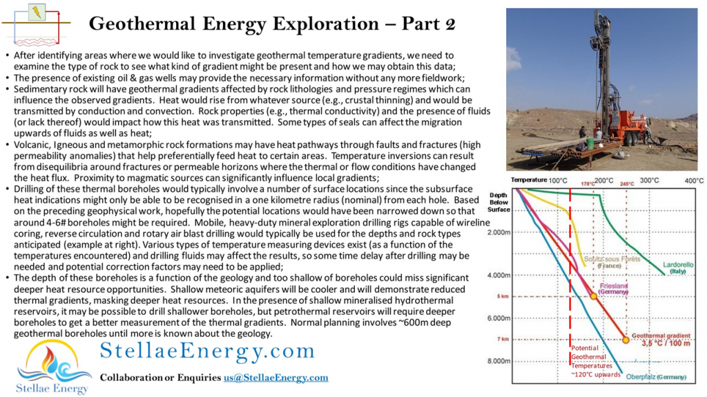
Thank you for all the interest in this series of posts. Depending on good results from the initial Geophysical field surveys (described in the Part 1 flyer), one of the next steps would be to obtain geothermal gradient information from shallow boreholes (up to 600m deep in some locations). A particular location’s rock lithologies and geological structures, including any shallow meteoric aquifers, need to be considered to set the depth of these boreholes. Too few or too shallow of boreholes can impede the collection of good data to correctly identify the location’s geothermal potential.
